


Notes From an Environmentalist; Bill Ryan's Forecast for Tuesday's storm.

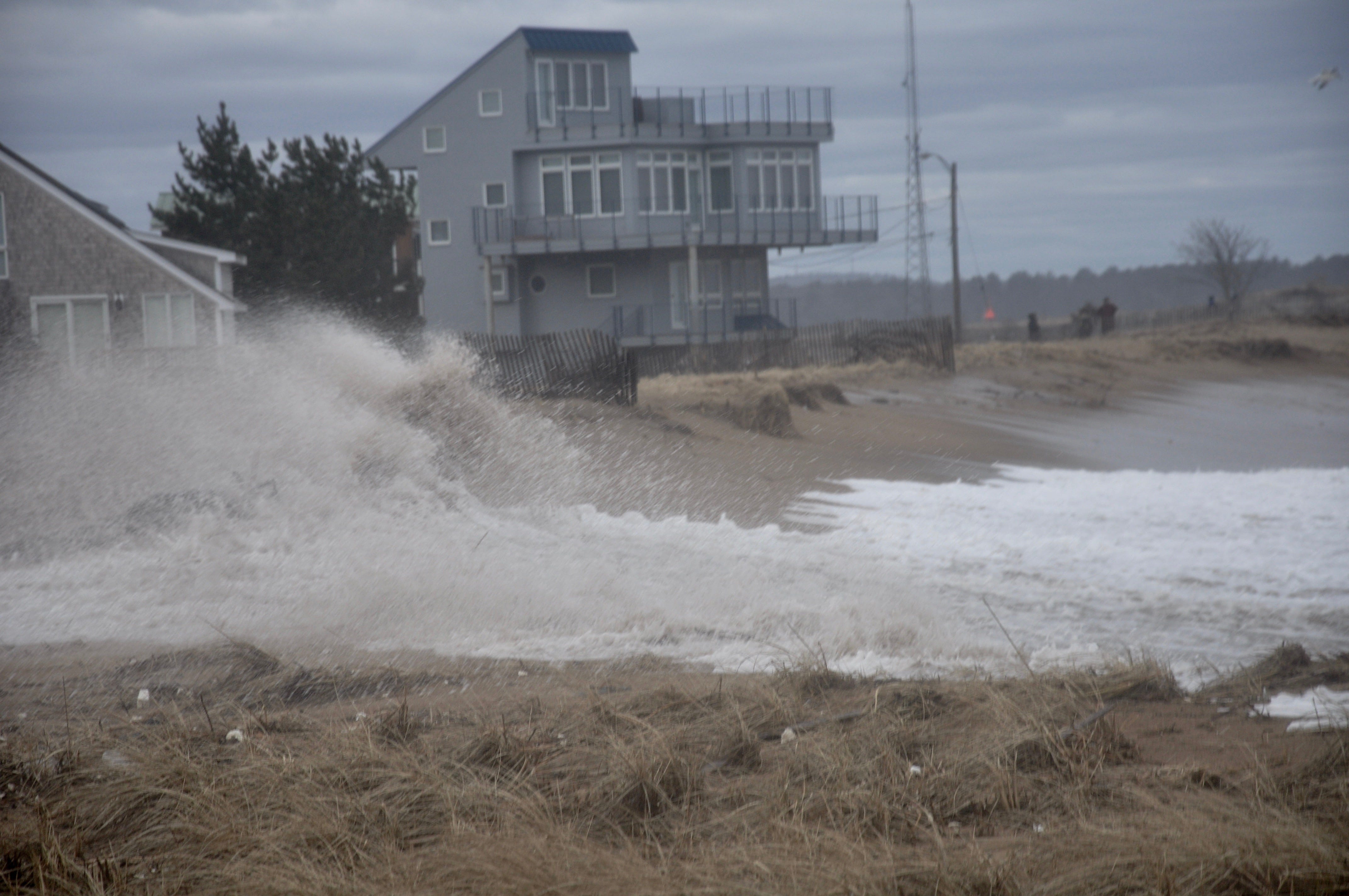
Photo March 3, 2018.
Bill Ryan’s Report for Tuesday’s Storm:
Coastal New England will be impacted by a fast moving storm Tuesday and Wednesday.
A low pressure system currently organizing in TX/LA will move up into western Tennessee early Monday. As is common with this type of pattern, called a "Miller Type B", https://en.wikipedia.org/wiki/Miller_Classification,
the main low will weaken as it interacts with the complex Appalachian terrain and a secondary low will form near HAT Monday night. This secondary low pressure center will strengthen very rapidly ("bomb") Tuesday as it tracks from the NJ coast to just south of Cape Cod by mid-day Tuesday.
This storm will be a heavy snow producer inland along a wide band from northern PA, through Albany and right across central MA. While the exact rain/snow mix for Cape Cod and the Islands is always a forecast headache, this one appears to be more snow than rain even along the coast. Expect a mix of rain/snow during the onset of the storm across the Cape Tuesday morning then all snow later in the day. Snow ending Tuesday after dark. The rain/snow forecast for the Cape is still uncertain as usual but the current forecast model guidance shows a 50/50 chance of accumulation >= 6" for the Cape. Higher amounts are likely for the remainder of MA.
Along with periods of heavy snow, the main impact of this storm will be high winds and coastal flooding. NE winds in excess of 20 kts is expected by sunrise on Tuesday strengthening to gale force by early afternoon.
We are already in a period of astronomically driven high tides (just past the new moon) and the current forecast suggests an additional storm-driven surge of 2-3'. The Tuesday afternoon high tide will be the period of most concern with strong NE winds driving surge and high seas along the east-facing coastline. Luckily this is a fairly fast moving storm so that the transition to NW winds (though still very strong) will occur around midnight Tuesday night. Strong NW winds will continue through Wednesday and into Thursday morning.
Bill
"Whatever truth drops on, it eventually grinds it to a powder." Art Blakey
Along 1A in NH……Seabrook, Hampton, No Hampton, Rye when high tide comes we will most likely see our raised stone walls which were places for raised boardwalks get washed into the 1A roadway. The state will once again use front end loaders to plow the roadway clear of the loose rocks. Hampton Beach areas will face flooding….again!